


3 Mountain Bike Itineraries in Bormio: Routes for All Levels
Discover 3 MTB itineraries in Bormio, from easy excursions to more challenging routes, immersed in nature. Start directly from the Miramonti Park Hotel.
As a family of sports enthusiasts who love every activity you can enjoy in our mountains, we’re here to recommend 3 routes that let you explore and have fun across our valleys. These are 3 itineraries of different difficulty (listed in order of intensity!) so that every two-wheel fan can choose a ride suited to their fitness level.
All three cycling excursions can be tackled on a mountain bike or on one of our pedal-assist e-bikes.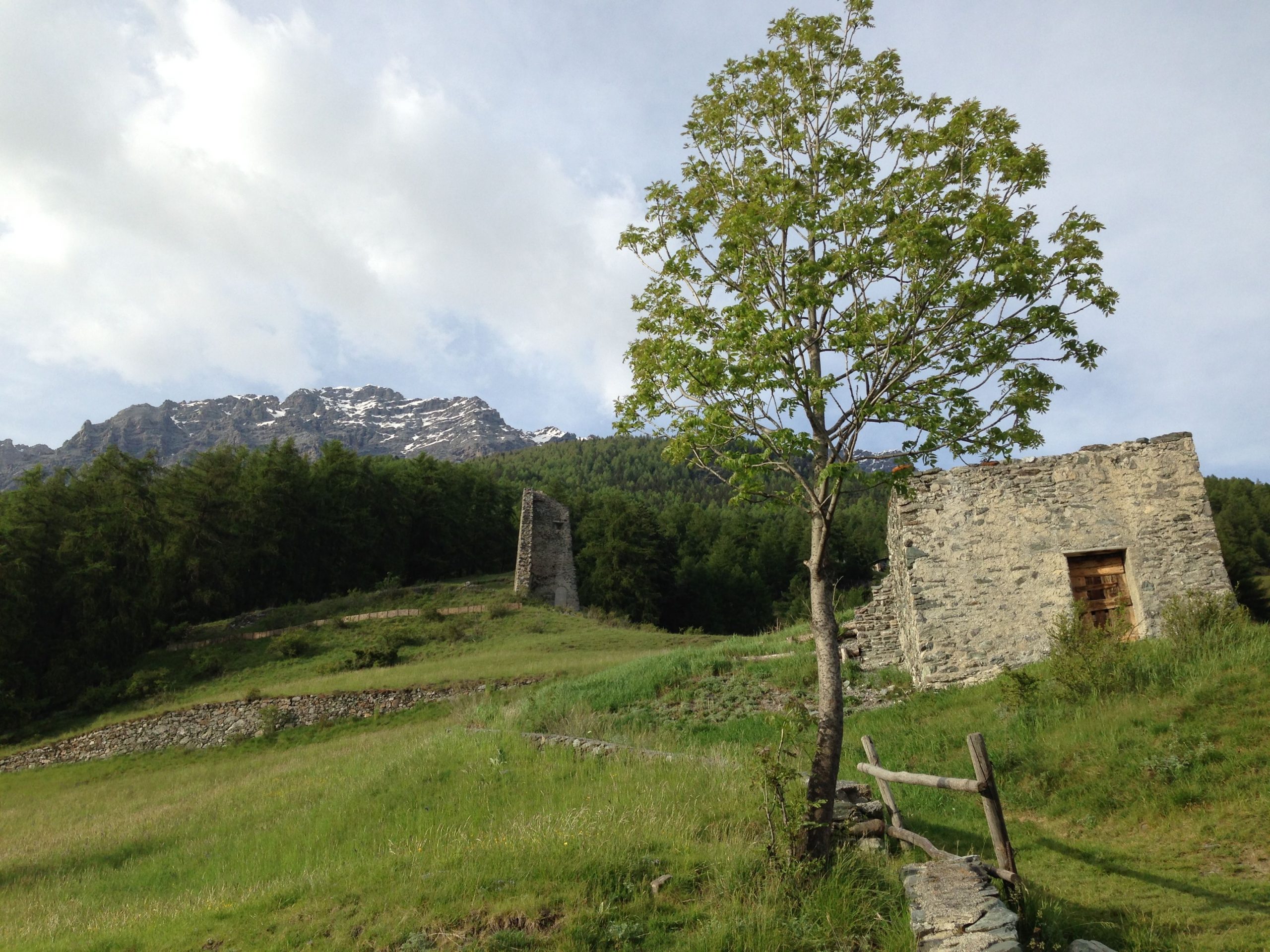
Continue for a long woodland stretch until you meet some junctions on the right that descend towards Bormio (way-marks 538 and 511), but we recommend turning left onto path S511 towards Casina Alta, a spring alpine pasture for dairy cattle.
Almost immediately, ignore another right-hand fork and keep on Val d’Uzza, gently climbing northwards.
You emerge from the forest below the looming rock faces of the Cresta di Reit, ford two valley streams (with a ford and a bridge at “Segheria Praolini”), then after a short uphill kick continue on path S531 (keeping right) to Teregua in Valfurva.
For the return, follow the cycle track to Uzza and just beyond the houses take the path on the right that leads into Bormio’s historic centre.
Curiosities / Points of interest: The trail winds through a beautiful larch forest (hence the name Monte Lareit, “lariceto”), whose autumn colours are spectacular. The route was built for military purposes during the Great War.
It overlooks the whole Bormio basin and offers a wonderful panorama of the old town from above, as well as many views of the surrounding peaks—directly opposite, Monte Vallecetta with its ski runs, and to your right the glacier-clad Cima Piazzi.
This area once yielded the distinctive green stone seen in many of Bormio’s architectural details.
Following the sign to Bormio, take a narrow path that leads through pastures and woodland to the ruins of St Peter’s Castle (or Gesa Rota, 1322 m), perched just above the town.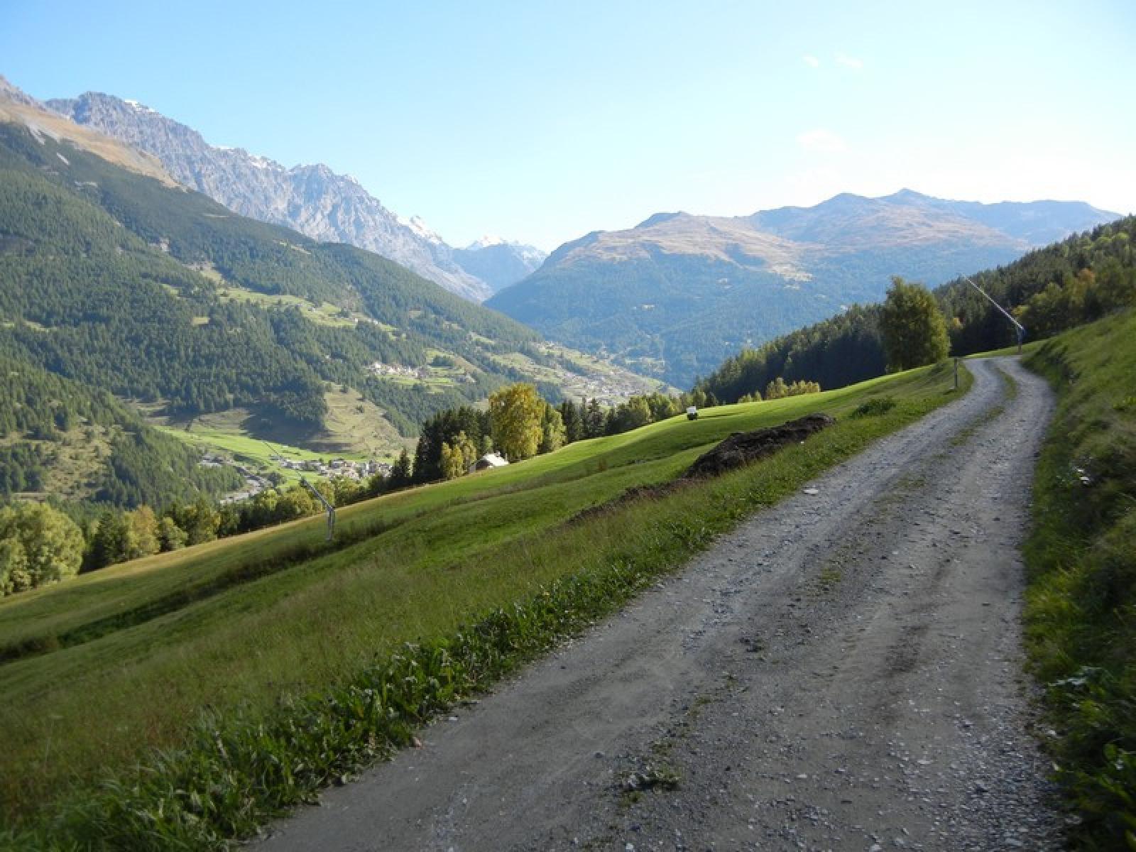
Before reaching San Pietro, join the level gravel track S540 that crosses the famous Stelvio ski run and leads to Campolungo.
The undulating trail winds through dense forest with enchanting viewpoints, then becomes gradually more demanding up to Calvarana.
From Calvarana descend on compact, flowing ground to the village of Sant’Antonio Valfurva.
Follow the main road to Uzza and, just past the houses, you can take path S540.2 over the Pont da Carosa back to Piazza di Combo via the church of Beata Vergine del Sassello.
Curiosities / Points of interest: At Campolungo you can continue straight on to reach the road up to Bormio 2000.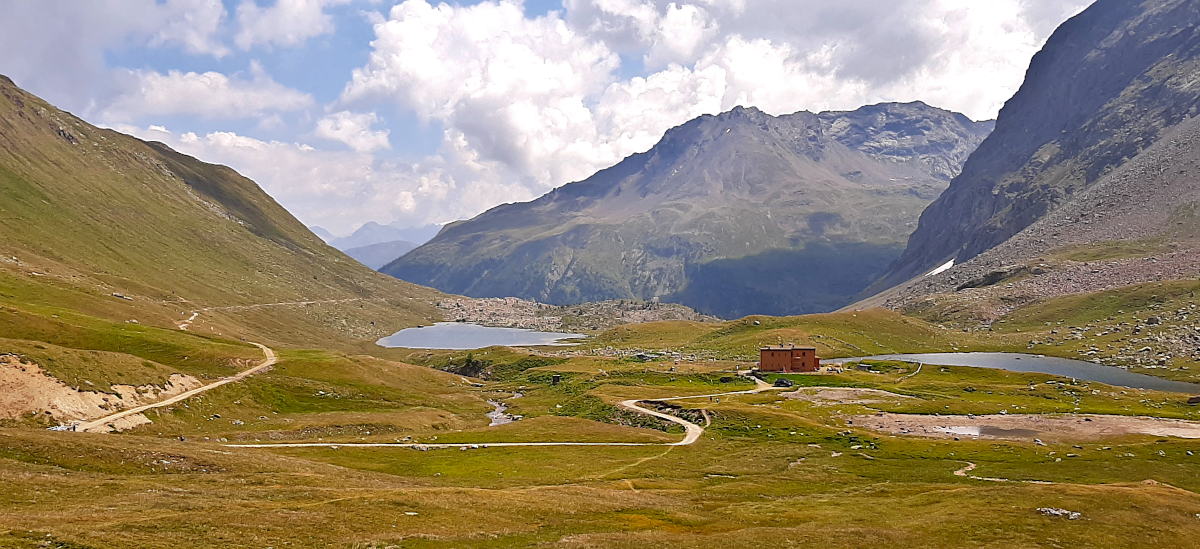
At the junction keep right to Fior d’Alpe and from there follow the road towards the Fraele Towers / Cancano.
Two bends below the towers, take the turn-off onto the Decauville track and follow it all the way to Arnoga.
From Arnoga a beautiful trail crosses the Val Viola Bormina.
Return by the same route or, alternatively, along the main road.
Curiosities / Points of interest: The valley is dominated by peaks of the Cima Piazzi and Corna di Campo groups: Cima Piazzi (3439 m), Cima Viola (3374 m) and Cima Dosdè (3280 m) tower over an unspoilt landscape.
The name Val Viola probably stems from a cartographers’ error in the 19th century, confusing “Albiola” (from Latin *albus* = white) with “Viola”, which has remained ever since.
Along the route you pass clusters of traditional mountain chalets built entirely of stone and wood; the largest, best-preserved settlements are at Dosso, Premoglio, Campo, Prato, Paluetta, Caprena, Stagimel, Caricc and Altumeira, where farmers once spent summers with their livestock, cultivating wheat and—above all—rye, widely grown here.
The vegetation is typical of high-altitude habitats, with colourful rhododendrons, fragrant gentians, anemones and many alpine flowers.
As for wildlife, besides ungulates, the area teems with marmots, whose shrill whistles echo throughout the valley.
With these 3 itineraries you’ll fill up on energy and beauty, discovering the wonders of our region in a healthy, fun way.
And as always, on your return, our SPA and culinary delights await as the perfect reward!
Dario Da Zanche
All three cycling excursions can be tackled on a mountain bike or on one of our pedal-assist e-bikes.
Pedemontana Della Reit
Bormio – Pravasivo – Cà Bianca – Giardin – Teregua – Bormio- Total route length: 14 km
- Total ascent: 350 metres
- Total descent: 396 metres
- Approximate duration: 1 h – 2 h
- Difficulty: hiking level (4 / 10)
- Within Stelvio National Park boundaries: yes
- Picnic areas along the route: yes
- Refreshment huts or refuges on the route: no
Continue for a long woodland stretch until you meet some junctions on the right that descend towards Bormio (way-marks 538 and 511), but we recommend turning left onto path S511 towards Casina Alta, a spring alpine pasture for dairy cattle.
Almost immediately, ignore another right-hand fork and keep on Val d’Uzza, gently climbing northwards.
You emerge from the forest below the looming rock faces of the Cresta di Reit, ford two valley streams (with a ford and a bridge at “Segheria Praolini”), then after a short uphill kick continue on path S531 (keeping right) to Teregua in Valfurva.
For the return, follow the cycle track to Uzza and just beyond the houses take the path on the right that leads into Bormio’s historic centre.
Curiosities / Points of interest: The trail winds through a beautiful larch forest (hence the name Monte Lareit, “lariceto”), whose autumn colours are spectacular. The route was built for military purposes during the Great War.
It overlooks the whole Bormio basin and offers a wonderful panorama of the old town from above, as well as many views of the surrounding peaks—directly opposite, Monte Vallecetta with its ski runs, and to your right the glacier-clad Cima Piazzi.
This area once yielded the distinctive green stone seen in many of Bormio’s architectural details.
Following the sign to Bormio, take a narrow path that leads through pastures and woodland to the ruins of St Peter’s Castle (or Gesa Rota, 1322 m), perched just above the town.
Valle di Calvarana
Park Hotel Miramonti Sport&Wellness – Piazza di Combo – Piatta – Campolungo – Calvarana – Sant’Antonio – Uzza – Pont da Carosa – Combo – Hotel- Total route length: 15 km
- Total ascent: 500 metres
- Total descent: 500 metres
- Approximate duration: 1 h – 2 h
- Difficulty: medium (6 / 10)
- Picnic areas along the route: yes
Before reaching San Pietro, join the level gravel track S540 that crosses the famous Stelvio ski run and leads to Campolungo.
The undulating trail winds through dense forest with enchanting viewpoints, then becomes gradually more demanding up to Calvarana.
From Calvarana descend on compact, flowing ground to the village of Sant’Antonio Valfurva.
Follow the main road to Uzza and, just past the houses, you can take path S540.2 over the Pont da Carosa back to Piazza di Combo via the church of Beata Vergine del Sassello.
Curiosities / Points of interest: At Campolungo you can continue straight on to reach the road up to Bormio 2000.
Val Viola from Bormio
Bormio – Decauville – Arnoga – Val Viola – Bormio- Total route length: 70 km
- Total ascent: 1100 metres
- Approximate duration: 5 h – 8 h
- Difficulty: high
- Picnic areas along the route: yes
At the junction keep right to Fior d’Alpe and from there follow the road towards the Fraele Towers / Cancano.
Two bends below the towers, take the turn-off onto the Decauville track and follow it all the way to Arnoga.
From Arnoga a beautiful trail crosses the Val Viola Bormina.
Return by the same route or, alternatively, along the main road.
Curiosities / Points of interest: The valley is dominated by peaks of the Cima Piazzi and Corna di Campo groups: Cima Piazzi (3439 m), Cima Viola (3374 m) and Cima Dosdè (3280 m) tower over an unspoilt landscape.
The name Val Viola probably stems from a cartographers’ error in the 19th century, confusing “Albiola” (from Latin *albus* = white) with “Viola”, which has remained ever since.
Along the route you pass clusters of traditional mountain chalets built entirely of stone and wood; the largest, best-preserved settlements are at Dosso, Premoglio, Campo, Prato, Paluetta, Caprena, Stagimel, Caricc and Altumeira, where farmers once spent summers with their livestock, cultivating wheat and—above all—rye, widely grown here.
The vegetation is typical of high-altitude habitats, with colourful rhododendrons, fragrant gentians, anemones and many alpine flowers.
As for wildlife, besides ungulates, the area teems with marmots, whose shrill whistles echo throughout the valley.
With these 3 itineraries you’ll fill up on energy and beauty, discovering the wonders of our region in a healthy, fun way.
And as always, on your return, our SPA and culinary delights await as the perfect reward!
Dario Da Zanche